IntelligentEarth MonitoringPowered by AI
From subsurface seismic analysis to satellite-based flood and drought detection — Geochange Technologies delivers actionable intelligence for a changing planet.
Our Products
Two powerful platforms for earth intelligence
Flood & Drought Monitor
Near real-time satellite monitoring of floods and droughts across Mozambique using Sentinel-1 SAR imagery with 12-day repeat cycles.
- ✓ Multi-sensor satellite analysis
- ✓ Terrain-aware classification
- ✓ Flood & water loss mapping
- ✓ Frequent monitoring updates
- ✓ Interactive web map viewer
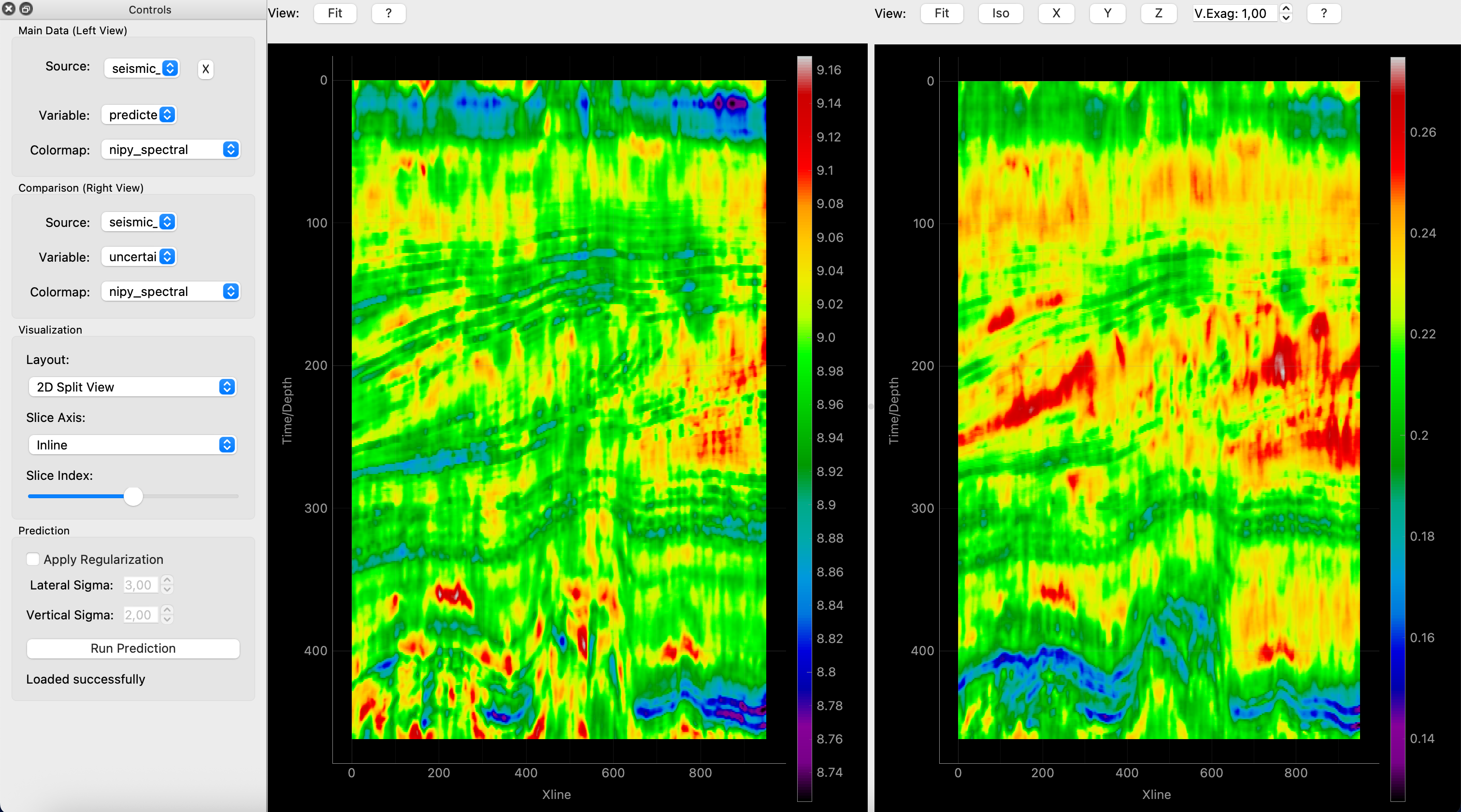
SegAI Seismic Prediction Pro
AI-powered seismic analysis that transforms seismic data into actionable rock property predictions with unprecedented accuracy.
- ✓ Acoustic impedance prediction
- ✓ Density & sonic property cubes
- ✓ Uncertainty quantification
- ✓ Custom model training
- ✓ Blind well validation
How It Works
Cutting-edge satellite technology meets advanced AI processing
Satellite Acquisition
Continuous ingestion of multi-sensor Earth observation data with automated quality control and calibration
Intelligent Analysis
Proprietary multi-temporal algorithms detect surface changes with high precision and minimal false positives
Terrain-Aware Refinement
Advanced topographic models enhance classification accuracy across diverse landscapes and elevations
Interactive Delivery
Results delivered through a responsive web platform with temporal navigation and layer controls
Advanced ML Models
State-of-the-art machine learning algorithms trained on extensive geophysical datasets for unparalleled accuracy.
Acoustic Impedance
High-resolution acoustic impedance predictions that reveal reservoir characteristics and fluid contacts.
Density Prediction
Accurate bulk density cubes that enhance lithology interpretation and rock property analysis.
Sonic Properties
Comprehensive sonic velocity predictions for improved depth conversion and pore pressure estimation.
Uncertainty Quantification
Confidence metrics for every prediction, enabling risk-aware decision making and quality control.
Prospect Identification
Automatically highlight zones of interest with anomalous properties indicative of hydrocarbon presence.
Real-World Results
Proven performance across major exploration fields and flood events
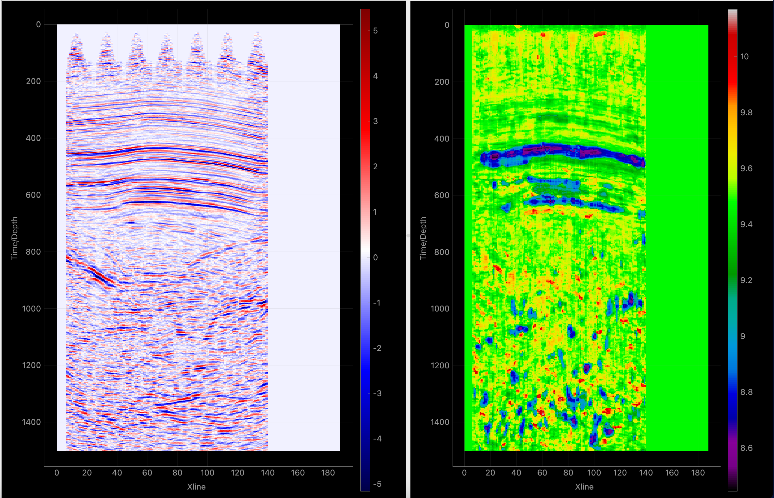
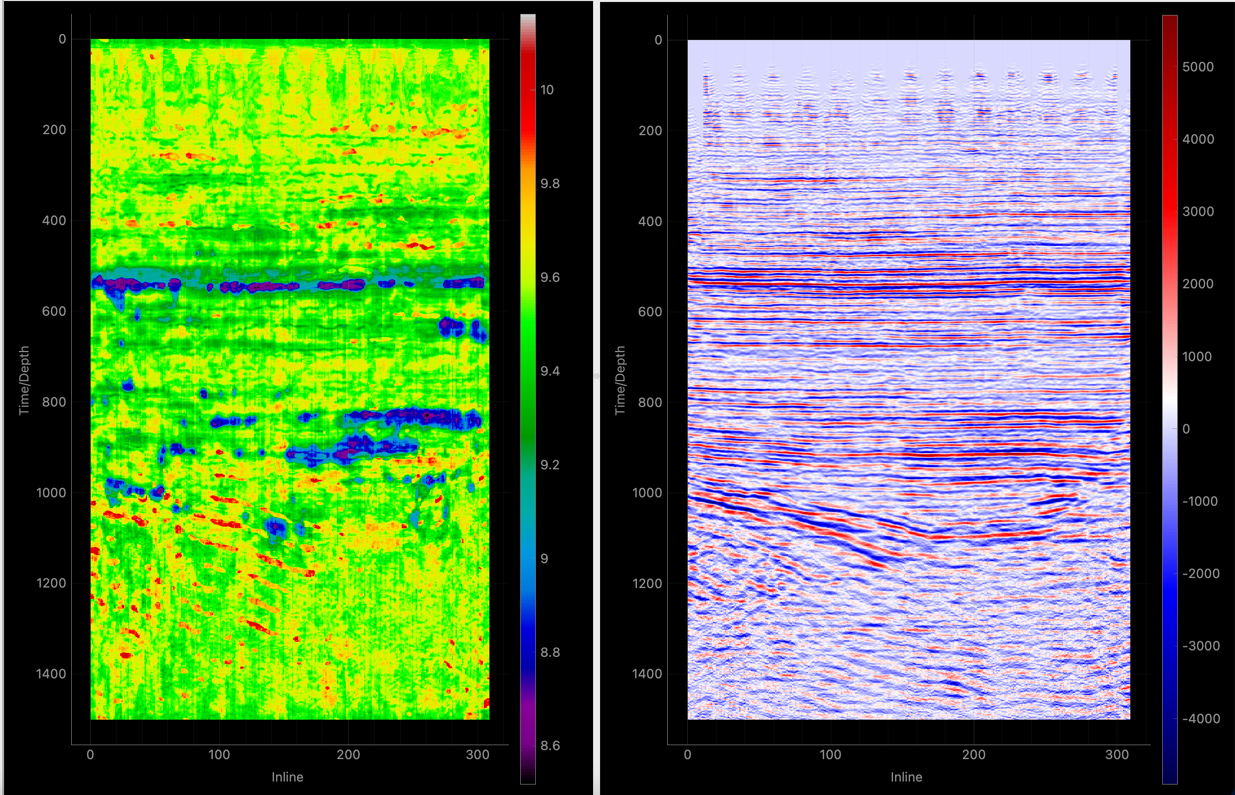
Teapot Dome – Inline
Low impedance zones identify reservoir intervals
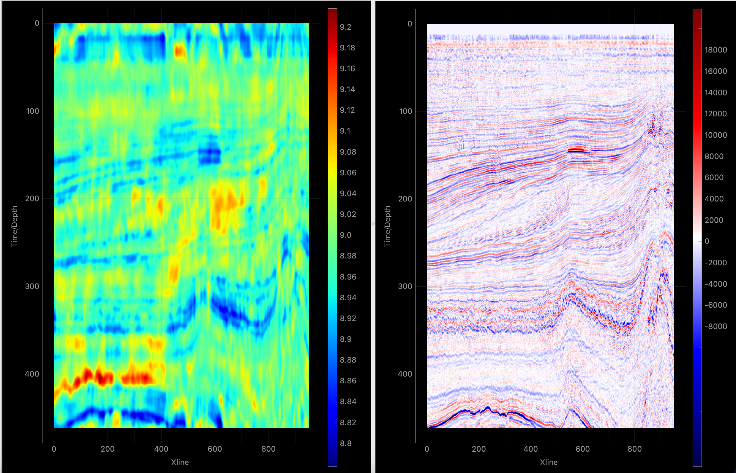
F3 Block – Netherlands
Stratigraphic features revealed by AI prediction
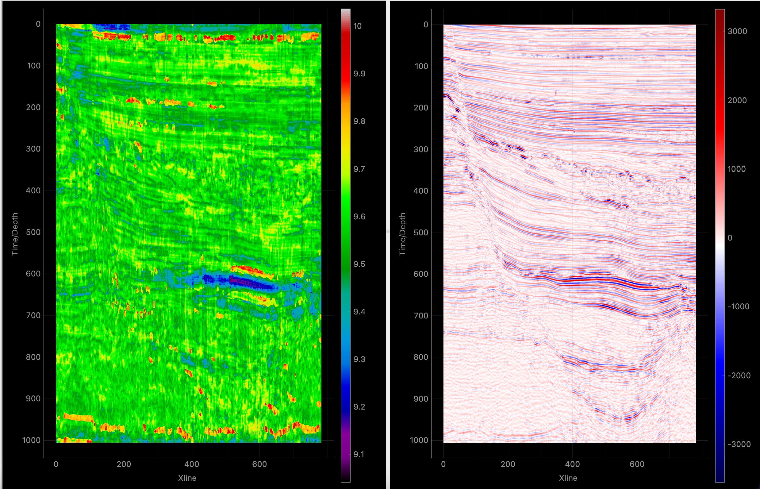
Parihaka Survey – New Zealand
Multi-layered reservoir system mapped at 95%+ accuracy
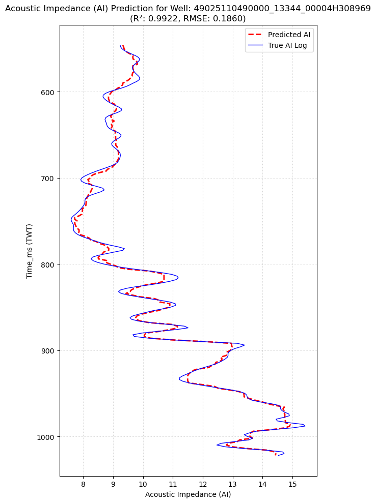
Well Log Validation
Predicted vs. actual well log comparison
Uncertainty Quantification
Prediction with confidence intervals
Stratton Field – Texas
Sweet spot identification for optimized well placement
Why Geochange?
Reduce Uncertainty
Quantify confidence in every prediction with advanced uncertainty modeling for better risk management.
Near Real-Time Alerts
12-day monitoring cycles deliver timely flood and drought intelligence for disaster response.
Maximize ROI
Data-driven decisions that reduce dry holes and optimize resource allocation.
Scalable Platform
From a single field study to country-wide monitoring — our platform scales with your needs.
Ready to Get Started?
Partner with us for AI-powered earth intelligence